Member-only story
Is the beast from the East back?
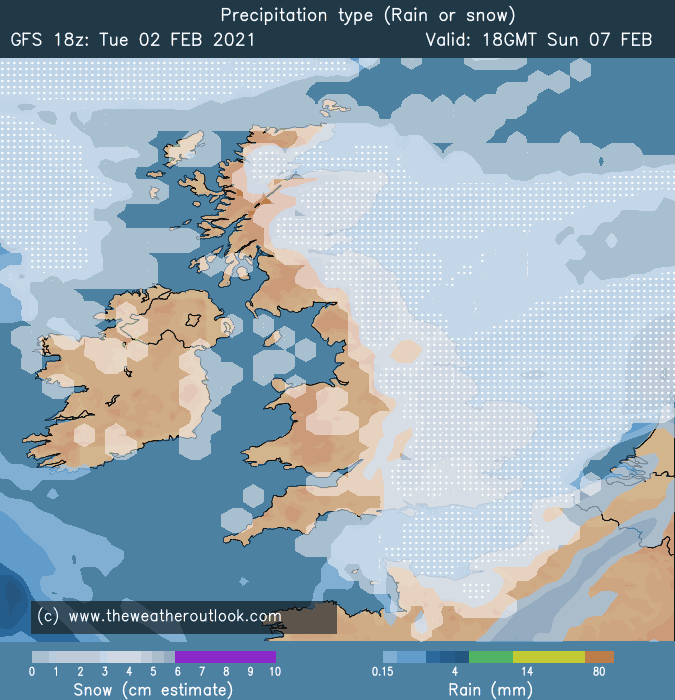
It is increasingly likely that the elusive beast from the east is back later this weekend and somewhere in the UK is going to get a serious dumping of snow!
The chances have increased to near 80% even for the snow-starved SE of England. Blizzards could appear and a bonus incredibly snowstorm from a channel low later next week.

This has all come about because of a cold plunge into Scandinavia and across the United States. These have increased the temperature gradients across Europe with a northerly push of hot air from Africa over Italy and Greece pushing northwards to meet the Arctic Air coming down from Norway. This energy will deepen the low pressure coming down across the UK on Friday and it should sit near the SE of England or near Holland/Belgium area. This will drag the Arctic air over the UK producing the Beast from the East. Always flirting with the warm air to the south this will increase the moisture in the atmosphere which in turn will produce the dumping of snow across the UK. Dragging the cold winds off the warm North Sea would mean that East Anglia could be buried in snow 30cm plus! But if the warmth is too close it could be lots of flooding. The snow would then be pushed further north over the Yorkshire area. Snow would be falling from Sunday till Wednesday building up the totals and amazing drifts would occur.

Meanwhile, on the other side of the Atlantic, the plunge of even colder air pushing down from Canada will increase the temperature gradients and could spin up a low-pressure system with winds like a hurricane. This will move across the Atlantic to the UK and run along the English Channel bringing another snow event across the SW and Southern England. Blizzards would occur in the 40 to 70mph hour winds. The wind chill factor would be an extreme minus 15c and below.

